
These are the latest weather links from
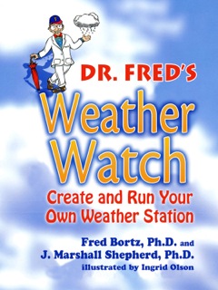
Chapter 7 of DR. FRED'S WEATHER WATCH: CREATE AND RUN YOUR OWN WEATHER STATION
by Fred Bortz, Ph.D. and J. Marshall Shepherd, Ph.D.
(StarWalk Kids Media, 2014)
Click here to send e-mail if you find a bad link below.
Click here to send e-mail if you want to recommend a new link for this list.
Thanks to volunteer Denise Chapman the students of The Brenham Community Center in Texas for telling me about how they used this page and suggesting a link. Even though I couldn't use it, I could tell that they are great Weather Watchers.
To learn more about Doppler radar, you can visit these web pages
For more information on weather satellites plus links to interesting satellite images, visit the GOES project.
Other satellite image pages include:
At many other sites on the world wide web, you can find real-time radar and satellite imagery to help you forecast weather changes in your neighborhood by seeing the weather that is heading your way. You may have to explore those sites a bit to find the data, but exploring them can be both educational and fun. Some of the best sites include the following:
The best on-line locations to find and study surface weather maps are:
Beyond Surface Maps: Weather patterns at the surface usually depend on conditions at higher levels of the atmosphere. Meteorologists also measure wind, pressure, temperature, and moisture patterns at different altitudes. For those, they use radiosondes, special balloons that carry instruments that measure the standard weather variables (pressure, temperature, humidity, wind speed and direction) and send the information back to the ground by radio signals.
This data from sites around the country can be used to create maps similar to surface maps for different levels of the atmosphere. This allows meteorologists to study the effects of upper air phenomena, like the high altitude wind called the "Jet Stream," on the surface weather. You can learn about the Jet Stream in the Weather Basics section of the USA Today on-line weather information pages.
Good sites for finding and studying upper air maps include:
Other NWS Information: All neighborhood weather watchers should keep in touch with their local NWS office. These offices issue weather measurements, special weather statements, and other information that are intended specifically for their local area. Your skill as a neighborhood forecaster will depend on knowing how your measurements compare to those official local measurements. You can visit your area's NWS on-line service through the following sites:
Many of the sites mentioned here, but specifically the National Weather Service and WeatherNet sites, also include a variety of forecast maps and data generated by the weather service's large weather prediction computer models. How do those computer programs use real measurements to produce daily, weekly, and monthly forecasts? Visit NOAA's National Centers for Environmental Prediction page to find out.
Other Useful Web Resources for the Weather Watcher
- The Washington Post Weather Reference is an excellent reference site. It contains a weather glossary with over 600 terms and a valuable definitions/explanation page. It also provides a weather calculator to perform simple but essential calculations like: Fahrenheit-Celsius Conversion, Wind Speed Conversion, Heat Index (a measure of the discomfort level on hot, humid days), and Wind Chill (a measure of how cold you the air feels when the wind blows).
- The Capital Weather Gang is a blog from the Washington Post that provides current and insightful information on weather and climate.
- The USA Today online weather information pages have clear weather explanations and diagrams, plus a weather glossary and weather library.
- The American Meteorological Society is the largest weather professional society in the U.S. and has a wealth of resources on weather, climate, and related information. Dr. Shepherd was the 2013 President of the AMS.
- The Athena Earth and Space Science K-12 education program's weather page allows students to observe, track, chart, and forecast weather systems interactively. Try it!
- The National Severe Storms Laboratory site is probably the most complete site for information on observing, tracking, and forecasting severe weather (such as thunderstorms, lightning, and tornadoes). If you ever wondered what "storm chasers" were looking for besides thrills, this site has the answers.
- Storm spotting from home. (Speaking of severe storms, this link comes from superstar summer STEMjuniors workshop student Mia and her teacher Katie Vogel of Lake County Tutor)
- Thanks to a 12-year-old aspiring EMT named Peyton for this link, which is a guide to being safe and prepared for severe storms at home.
- The National Hurricane Center site is one of the best places to learn about hurricanes and how they are observed, tracked, and forecast. There is a wealth of educational material and downloadable hurricane tracking charts. If you are the type of weather watcher who loves to track hurricanes, be sure to blow into this site during the season.
- Philadelphia's famed Franklin Institute Science Museum has a weather education site that has simple and accurate explanations of many weather terms. It also has a very comprehensive listing of all types of weather links
- If you liked the Facts, Figures, and Phenomena sections in Dr. Fred's Weather Watch, you will enjoy exploring the weather extremes pages of the National Climatic Data Center. It also has information about air and ocean conditions that influence the Earth's climate in important ways, such as the notorious "El Nino."
- The University of Georgia Atmospheric Sciences Program is the home program of Dr. Shepherd and has a wealth of information on how to become a meteorologist and other frequently asked questions. The page also links to a climate laboratory with real-time weather information collected from weather instruments like the ones you made.
- The Ultimate Weather Education Website provides an outstanding collection of weather tips on forecasting, basic atmospheric processes, and information.
- The Storm Prediction Center is one of the best sites for monitoring real-time severe weather threats in the United States. They provide an array of useful information and tools for monitoring severe weather.
- The National Weather Association is similar to the AMS but is a smaller organization. They serve as a good resource on a variety of weather related topics and issues.
- NOAA's climate portal provides a comprehensive set of tools, information, and stories to better understand the relationship between weather and climate.
- Climate Central is an outstanding non-profit organization that provides objective, non-biased information on our changing climate. Dr. Shepherd is a member of the Climate Central Board.
- The Ultimate Guide to Clouds, which has several useful links of its own. (Recommended by a reader on May 12, 2010, and approved by Dr. Shepherd.)
- Dr. Fred's Review of The Cloudspotter's Guide by Gavin Pretor-Pinney, founder of the Cloud Appreciation Society. A wonderfully descriptive and entertaining book.
- Tornado Safety Links
- Of course, tornadoes are not the only weather-related disaster. Click here for the whole ready.gov site that includes preparations for hurricanes, floods, and wildfires.
Weather Stations: Commercially available weather stations range in price from a few dollars to thousands of dollars. If you decide to invest in weather equipment, first check with your parents about how much they are willing to spend. Then shop carefully, and don't buy anything without your parents' approval.
The first step is to show them what you have already done and explain to them why you are ready for better equipment. If you do that right, you may discover that at least one parent is a "weather weenie" just like you.
Weather Stations are also available at many hobby stores, museums, and gift shops. Before you go to a store, you might want to look at the following sites on the world-wide web to see what is available. We aren't endorsing any of these sites, but visiting them will help you understand what weather instruments and software are available in a variety of price ranges to expand or build your weather observatory. (Listed alphabetically)
Weather Organizations
The American Meteorological Society is the largest and most complete professional organization for people in the fields of weather and climate. Through AMS, weather watchers, weather weenies, and weather professionals can find the latest publications and booklets on weather and climate, information on careers in weather or meteorology, information on scholarships, local AMS chapter directories, and many other useful resources.
The National Weather Association is similar to the AMS but is a smaller organization. They serve as a good resource on a variety of weather related topics and issues.
Return to Dr. Fred's Weather Watch main page.
Text copyright 2001-18 by Alfred B. Bortz, all rights reserved
[Dr. Fred's Office |What's
New? | Meet Dr. Fred! |
Books By Dr. Fred |
Ask Dr. Fred |
School Visits | Dr. Fred's
Certified Children's Books |
Science Project Discussion Area | Links To
Fellow Writers ]
Dr. Fred logo and art may not be reproduced in any form for commercial or educational use without the written permission of its owner, Alfred B. Bortz.